Rated 4.7/5・90,000+ Units Sold

Save time, bid accurately & maximize profits
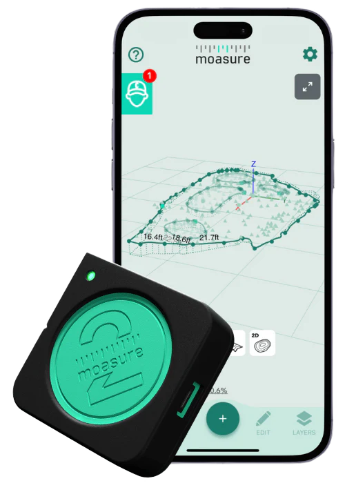
Measure & draw irregular job sites

Calculate area, volume & elevation

Export to PDF, CAD or CSV

Locate & mark points with Layout Mode

Try it with our 60-day money-back guarantee

Trusted by thousands of professionals around the world

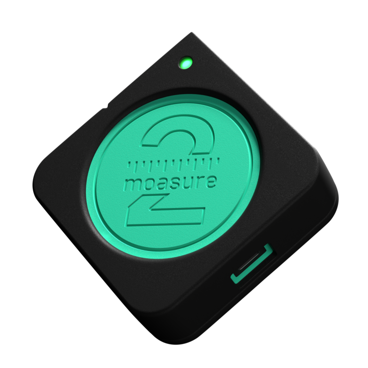
Meet the motion-based measurement device that contractors can’t stop talking about.

Paid for itself Already

Moasure allows us to simply plot out the project, run our topography, and finalize our runs. After just two and a half jobs, it has already paid for itself in labor and time savings.

Impact Landscape

Landscaping & Remodelling

Verified Review

Winning Twice as many Jobs!

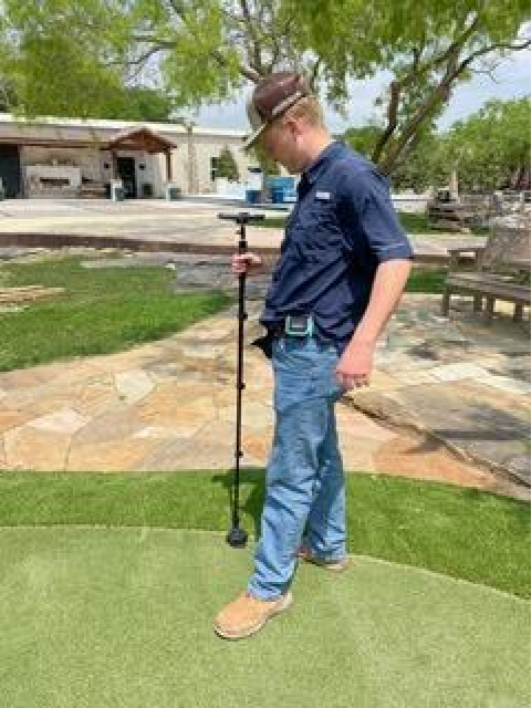
Sending my customers a PDF of the measurements so they can see that they are being charged correctly has helped me win twice as many jobs.

Texan Pride LLC

Residential Contractor

Verified Review

90% Less Measuring Time

We frequently measure playgrounds and this tool took a tedious process and made it simple. In 10% of the time, we can measure and easily communicate the dimensions with our design teams.

Recreation inSites LLC

Residential Contractor

Verified Review

No More Guesswork

Many of the jobs I measure are not easily measured with a wheel. With Moasure I can measure a clients project in half the time as it previously took me and not have to question the accuracy.

Harland Concrete

Concrete

Verified Review

Exports into DynaScape

Moasure has improved the profits of my projects. Not only am I able to save time measuring sites and collecting elevations, but exporting to DynaScape saves me time in the office too.

Weller Brothers LLC

Landscaping

Verified Review

Intricate Paths are Easy

Whether we are mapping out intricate garden paths, custom patios, or elaborate retaining walls, Moasure ensures that every measurement is spot on, eliminating guesswork and reducing the margin for error.

Globe Green LLC

Landscaping

Verified Review

Choose your Moasure

arrow-right

Try it with our 60-day money-back guarantee

90,000+ Moasure units sold across:

Landscaping

Irrigation & Drainage

Construction

Artificial Grass

Pool Construction & Design

Playgrounds

Decking

Concrete

Fencing

Excavation

Difficult measuring made easy

Moasure makes measuring complex shapes a breeze. No GPS, data or line of sight required.

Generate accurate dimensioned drawings while you move.

Effortlessly measure and draw complex areas simultaneously. Simply trace along the edges of an area using your Moasure device to digitally capture the shape and dimensions. Add multiple layers within one measurement to simplify your workflow.

Automatically calculate the square footage and perimeter of a measured area.

Simply measure the perimeter of curved lawns, pools and other irregular spaces with your Moasure device and the perimeter and area will be automatically displayed in your Moasure app.

Measure elevation, determine grade, calculate rise & run.

From measuring complex shapes like sloped lawns or steps, to calculating rise and run or assisting with topographical surveys and drainage – difficult measuring is made easy with Moasure.

Generate 3D terrain maps, calculate true surface area, volume, and contour lines.

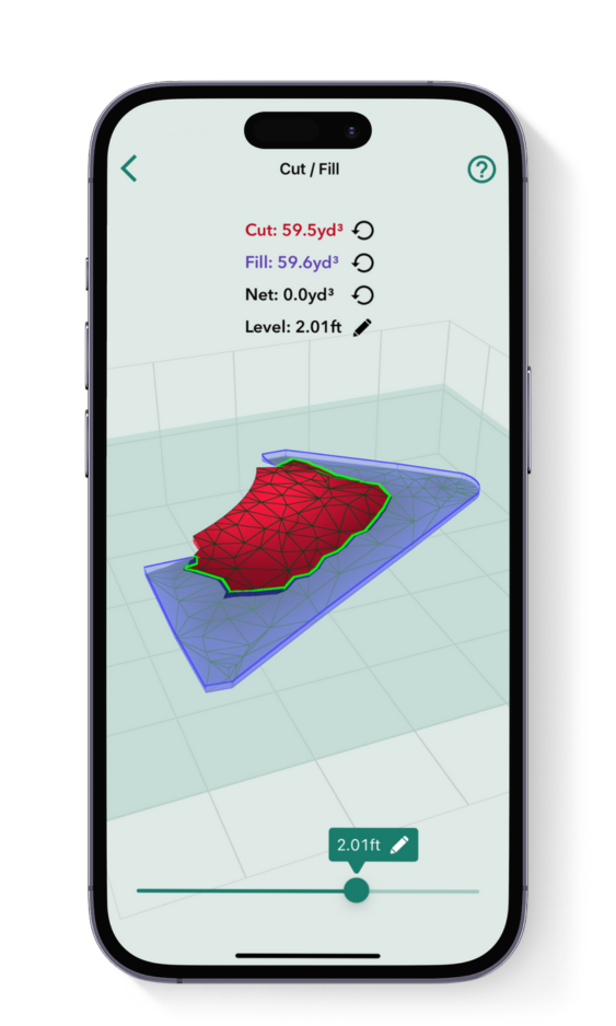
You can also effortlessly calculate the Cut & Fill, making earthwork projects more efficient and profitable. Whilst the ‘Add Depth’ tool allows you to add custom depth and calculate the required volume of material for a site.

Share measurements with clients, colleagues or your favorite design software.

Generate detailed, scaled PDFs, export to DXF or DWG for CAD applications, manipulate data with CSV exports, or visualize measurements using PNG, JPG and SVG formats.

NEW: MOASURE 2 PRO EXCLUSIVE

Stake out points based on entered coordinates.

Simply import your coordinates to the Moasure app and you will be quickly guided to each point to speed up your laying out process.

Choose your Moasure

arrow-right

Try it with our 60-day money-back guarantee

Moasure is compatible with:

Powerful in-app tools

Utilize the Moasure app's powerful suite of tools and features to inspect and enhance your measurements.

Cut & Fill tool

Calculate the volume of material to add or remove from a site, or determine the level at which to adjust your site for net zero volume.

Labels & backgrounds

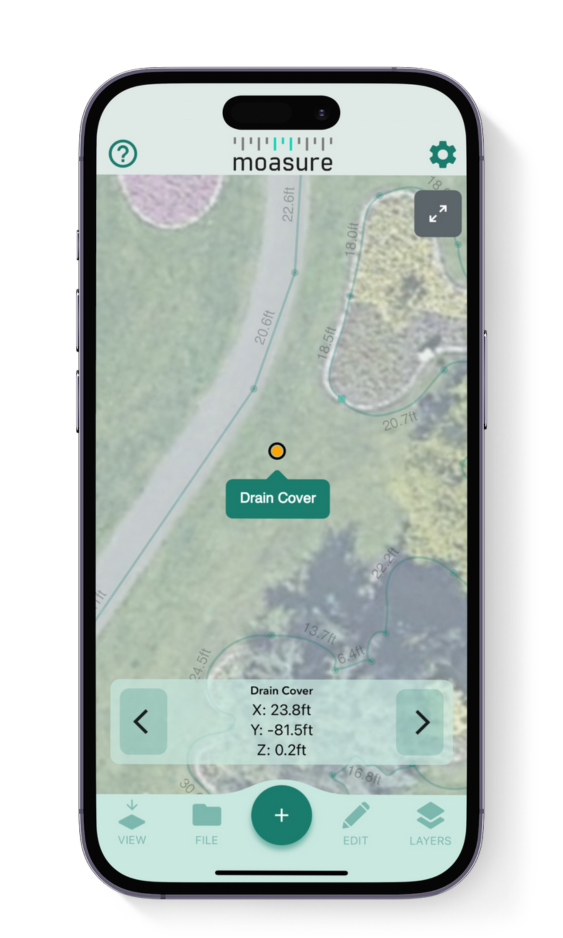
Label points of interest and overlay your measurement on an aerial shot of the area to help clients or colleagues visualize your project.

Organize your files

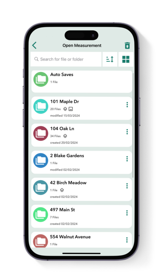
Save your Moasure files and organize them into folders all within the app.

View in 3D

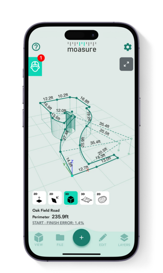
Moasure captures 3D terrain and provides multiple views in both 2D and 3D formats.

Calculate elevation

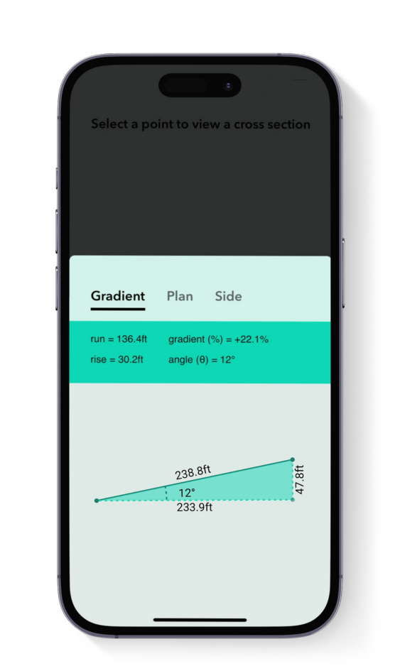
Using the cross section view, you can calculate the gradient, angle, and rise and run between 2 points.

Contour View

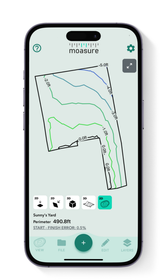
Contour view allows you to see the topography of your measurement.

Available on iOS & Android

Choose your Moasure

arrow-right

Try it with our 60-day money-back guarantee

Begin your Moasure journey

All it takes is three steps to master Moasure and take fast, accurate measurements.

1

Get to know your Moasure

We'll send you a getting started guide while your device is on the way. Have a read to understand motion-based measuring, a new way of measuring.

2

Learn the Basics

Get hands-on with your Moasure device. If you have questions, check out our video tutorials or contact our support team for help with specific features and techniques.

3

Maximize your profits

Practice using Moasure to become more efficient at accurate measurements. Streamline your workflow, create professional PDFs, and export data to CAD.

Choose your Moasure

arrow-right

Try it with our 60-day money-back guarantee

The Moasure impact

From saving time to winning new jobs, discover the impact Moasure has had on its users.
62%

Reduction in hours spent measuring per week

*Based on April 2024 study of 1,739 experienced Moasure users

Choose your Moasure

arrow-right

Try it with our 60-day money-back guarantee

Made for every job site

The Moasure 2 series is built for your toughest jobs in the harshest environments.

Water Resistant

IP67 Rated.

Measure in rain or snow.

Impact Resistant

Engineered to survive 6ft drops onto concrete.

10h

Long-Life Battery

Up to 10 hours of measuring time.

No GPS Required

No Wi-Fi, GPS or mobile data required.

2-Year Warranty

Try it with our 60-day money-back guarantee

Choose your Moasure 2

Start your journey to saving hours of time and thousands of dollars

Highest accuracy

Moasure 2 PRO

$899 excl. taxes

Includes Layout Mode & Dynamic Intervals

Moasure 2

$699 excl. taxes

Next generation motion-based measuring

Shop Moasure 2

arrow-right

Shop Moasure 2 Series

arrow-right

Measure & draw irregular job sites

Calculate area, volume & elevation

Export to PDF, CAD or CSV

Accurate to

within ± 0.3%

Accurate to

within ± 0.5%

Moasure 2 PRO:

Linear Distance: ± 0.3% error · Perimeter: ± 0.5% error · Elevation: ± 0.3% error · Area: ±1% error · Volume: ± 1.5% error · Layout ± 1% error

Moasure 2:

Linear Distance: ± 0.5% error · Perimeter: ± 1% error · Elevation: ± 0.5% error · Area: ± 2% error · Volume: ± 3% error · Layout: Not available on Moasure 2

Layout Mode

Moasure 2 PRO Exclusive

Layout Mode enables you to locate and mark points based on a set of predetermined x, y coordinates, with real-time guidance from the Moasure app.

The X2-PRO Inertial Sensor Engine’s enhanced accuracy provides industry professionals with a completely new way to set out.

X2-PRO Inertial

Sensor Engine

X2 Inertial

Sensor Engine

Our X2 and X2-PRO Inertial Sensor Engines leverage accelerometers, gyroscopes, and a second-generation proprietary algorithm to deliver a new and innovative way to measure.

The X2-PRO is our highest-performing engine yet, with six times the measurement processing capability of the X2, further increasing its accuracy.

Dynamic Intervals

Moasure 2 PRO Exclusive

Double the time between pause points for the same level of accuracy as Moasure 2, a feature that is useful for large job sites. Alternatively, you can maintain the standard pause interval time for maximum accuracy.

10 hours' continuous

measuring time

5 hours' continuous

measuring time

Plus, everything else included in both:

Moasure STICK Kit

IP67 Water Resistant

USB-C

-14°F to 122°F Operating Range

Free Moasure Companion App

Shop Moasure 2 Series

arrow-right

Try it with our 60-day money-back guarantee

90,000+ units sold & counting

Once you’ve made the switch to Moasure, you’ll never look back.

Customer Reviews

Based on 1138 reviews
83%
(949)
10%
(112)
3%
(35)
1%
(14)
2%
(28)
A
A.M. (Australia)
Moasure 2 PRO is a Game Changer!!!

I purchased the moasure 2 PRO to help with pre contract site inspections for a shed builder. I am a design expert and project manager in one.
The Moasure 2 PRO has helped gain valuable site data, much quicker than using old school lasers.
The more I use it, the more I am learning.

G
G.D.s. (United States)
Which Moasure Device did you purchase?: Moasure ONE
Choose the industry that best matches your line of work: Excavation
Tell us how long you've been using Moasure: 6+ months
Amazing!

This equipment is fantastic with great vertical accuracy. I wish the software team would add the terrain profile option with all the points collected like in the attached photo.
Thank you Moasure team.

k
k.d. (United States)
Which Moasure Device did you purchase?: Moasure ONE
Choose the industry that best matches your line of work: Construction
Tell us how long you've been using Moasure: 1-3 months
construction of trails/roads on rough steepish terrain

it's an interesting and potentially useful device for small landowners who may be dealing with fire protection issues and outdoor trail and road construction..
i'm still learning, rewatching videos, but i'm starting to get some useful measurements with intermittent spotty efforts over last several weeks.
i realized i needed to do some smoothing/brush clearing to measure effectively, so that has delayed progress. i'd still like more auditory feedback on what device is doing.
today i figured out how to switch modes to add points within a volume.
but cut/fill on my trail is still challenging me.
i have volume estimate of 200 cu yds + to bring bottom up to reduce grade. but i'm going to need to cut the top as well to get to reasonable grade. perhaps i need the net 0 cut/fill,
or perhaps i'm not choosing right starting point.
we've roughed out the trail by eye and smoothed. so i'm going to try again more carefully. by walking up grade, stepping over to other side and walking down the grade and stepping over to starting point....

S
Shelby Kerkvliet (United States)
Which Moasure Device did you purchase?: Moasure 2 PRO
Choose the industry that best matches your line of work: Construction
Tell us how long you've been using Moasure: 1-3 months
Endless Possibilities!

I purchased Moasure 2 to try out the layout mode, knowing that I could utilize it in other ways than just that. After trying layout mode, I could tell that the device takes a little skill to run. After a bit of practice, I was able to mark out a layout spot on! However, I need consistent pinpoint precision for my layouts, that Moasure 2 may not yet be able to offer. Layouts for applications that don’t need quite as much precision would work awesome!

That said, it’s extremely useful in other estimating scenarios! I’ve been able to utilize the 3D terrain mapping to map grade, and then later, drop a foundation into the model at the desired height to compare existing grade to a future foundation. Pretty awesome!

S
Spencer Thornton
Moasure has given us invaluable data that was difficult and too expensive to obtain

We have been working on a project in Upstate NY, which is a 72-acre site we are developing into a 9-lot compound of high-performance CLT houses. We want the architecture to respond to the site context, so getting real world data of the plots of land where we are planning on placing the homes was crucial. Moasure has been very helpful in doing that. 72 acres is of course too much to survey, and we don't really need all of it surveyed, just portions of it. So, for the overall 72 acres we used USGS topo data, which is too general for our needs, and then we took to the field with moasure to take highly accurate measurements of specific portions of the land.

On site, moasure did take some getting used to. I practiced using it in the city, but on site there was tall grass that was constantly brushing against the device, and the ground was covered in leaves, which made it a little difficult to have moasure come to a complete stop. But, after a little trial and error, I got it working. Moasure was able to quickly and accurately take a survey of our sites. However, we still needed to geolocate the data, so we know where the data we took is, in relation to our overall site. So, we took 2 points in moasure a set distance apart, and then also marked the same points on an GPS app we use called Theodolite. That way, back in the office, we have been able to align our moasure data to the USGS topo map that we already have. The moasure data had a much finer grain of detail, so we have been able to update our site model, which is exactly what we needed.

We as a firm are constantly excited to try new technology we find that will make our lives easier, and our architecture better. We used other technology on our visit, including the apple vision pro, that we chronicled in a blog post you can check out here: https://mesh.nyc/geospatial_surveying_techniques_and_visualization/

Overall, in conjunction with our other tools, moasure has given us invaluable data that was difficult and too expensive to obtain otherwise. For this
project, moasure has allowed us to more thoughtfully integrate our architecture into the site context.

Frequently asked questions

Everything you need to know about Moasure 2 & Moasure 2 PRO

No, there are no ongoing costs or subscription fees.

United States:

Free 3 to 5 day tracked shipping

1 to 2 day express shipping

International:

We ship to over 150 countries with shipping time between 10 to 15 days - see details at Checkout

Export any of your measurements and drawings from the app in any of the following formats:

PDF – export 2D and 3D drawings and measurements

PNG & JPG – export an image file of drawings and measurements

DXF & DWG – export 2D and 3D files (compatible with popular CAD programs like AutoCAD, SketchUp and Vectorworks).

'Layout' mode, exclusive to Moasure 2 PRO, enables you to locate and mark points, simplifying the layout of plans and designs.

CHOOSE YOUR MOASURE RISK-FREE

100% money-back guarantee

Every Moasure device is tested to ensure it meets our accuracy and precision standards.

Plus, every order comes with a 60-day money-back guarantee as standard.

Thousands of professionals have transformed their workflow with Moasure.

Give it a try and you’ll never look back.

Choose your Moasure

arrow-right

Try it with our 60-day money-back guarantee