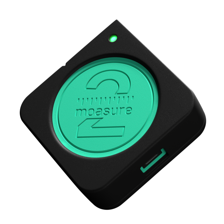
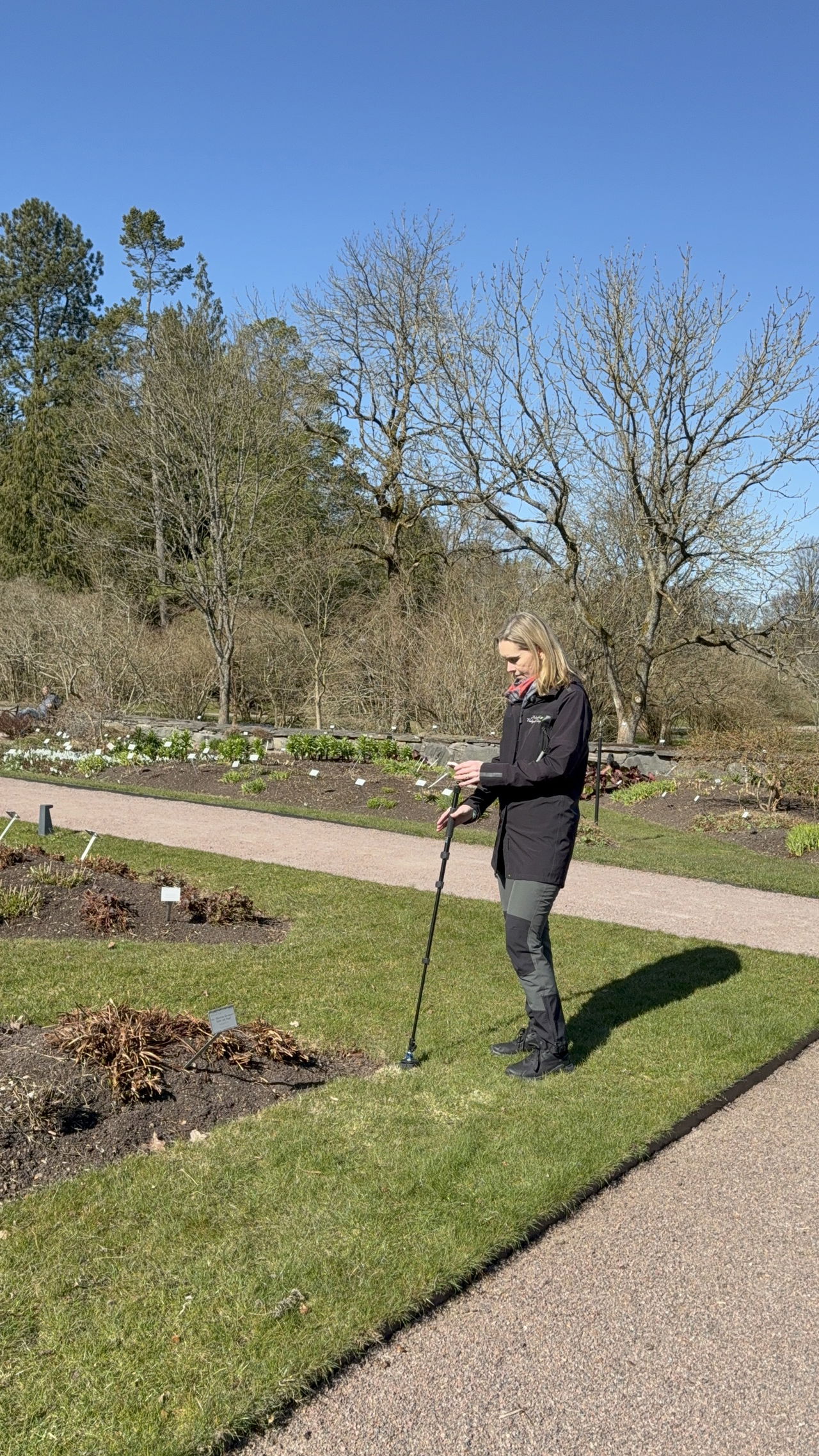
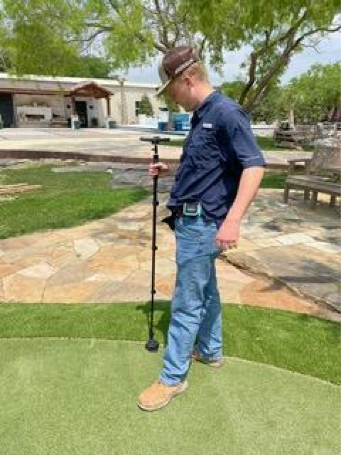
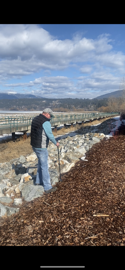
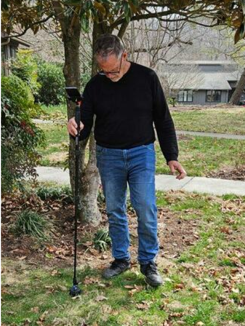
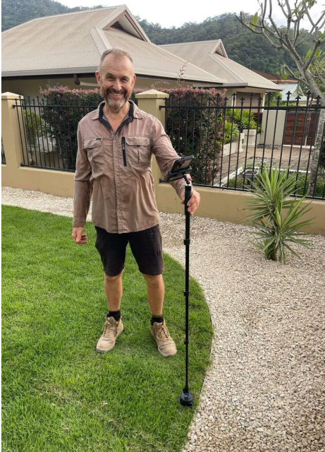
Moasure for landscapers
Accurately measure irregular job sites in minutes
The time-saving measurement tool used by thousands of landscapers all over the world.
Featured customers:


Read time: 1 min
5 reasons why landscapers are switching to Moasure
Here’s why everybody in landscaping is talking about Moasure:

1
1
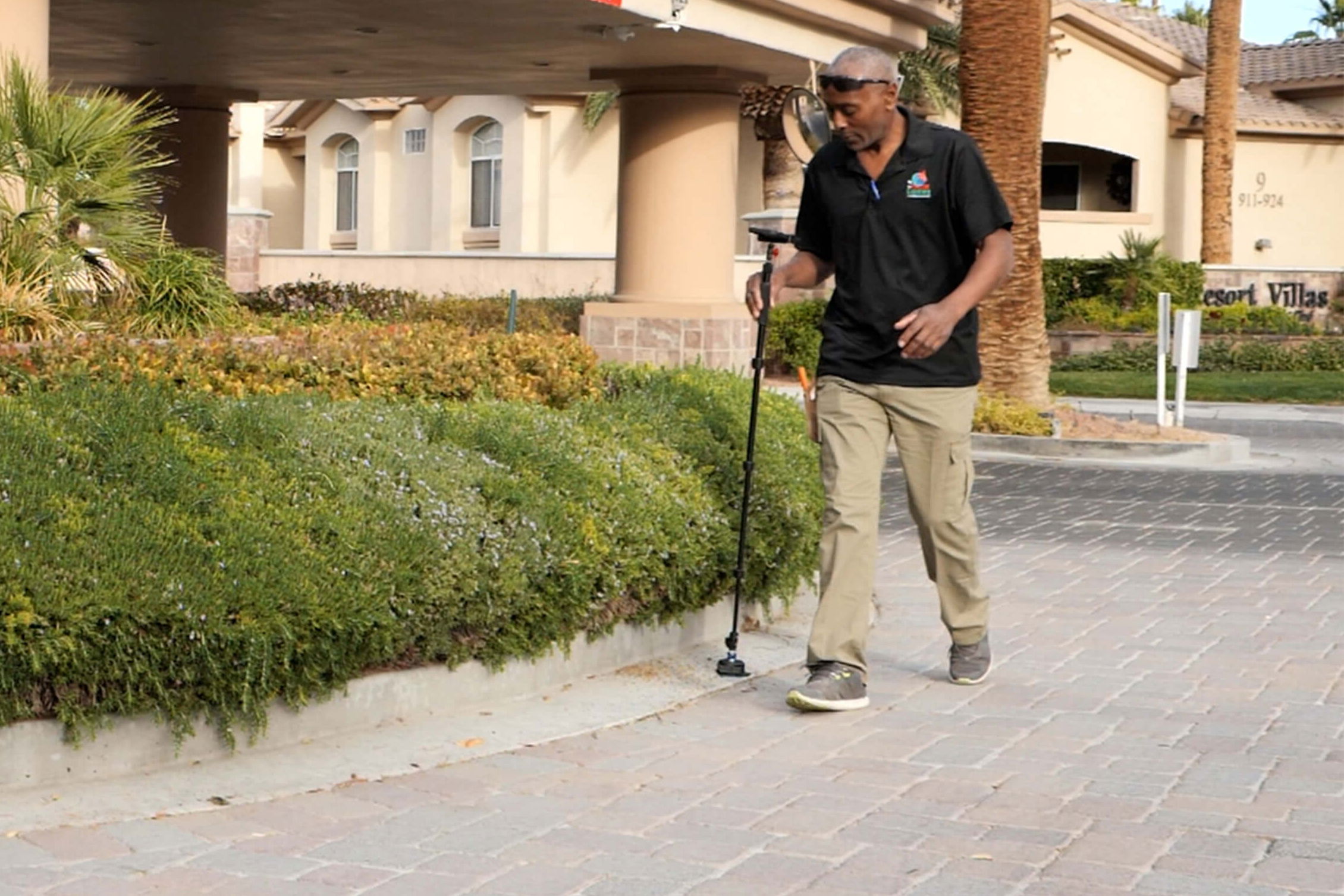
Easily measure the square footage of irregular job sites
Accurately measure and draw complex gardens, driveways or paths in minutes with Moasure as you walk. Square footage is automatically calculated – no math required.
2
Capture elevations as you move
Not only does Moasure measure distance in real-time, the grading is captured too. Calculating the rise and run between any two points is easy.
2
3
3
Instantly visualize site topography
Generate the topography of any measurement with just a few taps on the free Moasure app. Plan drainage or grading effortlessly.
4
No more over-ordering sod, concrete, mulch, or gravel
With Moasure, there’s no guesswork when it comes to material ordering. Determine the exact amount of material needed, boost profitability, and undercut the competition.
4
5
5
Export your drawings into CAD, or as PDFs, CSVs or images
Moasure’s free mobile app fits seamlessly into your existing workflow. Effortlessly export your drawings into CAD or share a site survey PDF with customers – complete with your company logo.


100,000+ sold
Landscapers around the world have made the switch to Moasure and not looked back.


Essential to our bottom line
I know the exact amount of materials needed for different phases of our jobs. Odd shaped turf areas, walk paths, or driveways; I'm not worried about ordering excess or a shortage of materials.
Olmos Landscape
Landscaping
Verified Review
Paid for itself already
Moasure allows us to simply plot out the project, run our topography, and finalize our runs. After just two and a half jobs, it has already paid for itself in labor and time savings.
Impact Landscape
Landscaping & Remodelling
Verified Review
Game changer
I take Moasure to every single job site. It collects the data efficiently, and accurately every time. With a few clicks, I can fire off the collected data to co-workers, clients, or myself. I‘m now building the landscape in a matter of minutes. Not hours!
Dixon Landscapes
Landscaping
Verified Review
Exports into DynaScape
Moasure has improved the profits of my projects. Not only am I able to save time measuring sites and collecting elevations, but exporting to DynaScape saves me time in the office too.
Weller Brothers LLC
Landscaping
Verified Review
Intricate Paths are Easy
Whether we are mapping out intricate garden paths, custom patios, or elaborate retaining walls, Moasure ensures that every measurement is spot on, eliminating guesswork and reducing the margin for error.
Globe Green LLC
Landscaping
Verified Review
Powerful in-app tools for landscaping projects
Utilize the Moasure app's powerful suite of tools and features to enhance your landscaping measurements.
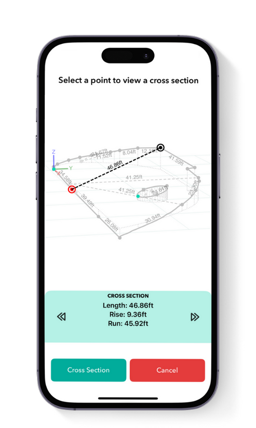
Calculate elevation
Determine the grade, angle, and rise and run between any two captured points with the Cross Section tool. Discover the elevation of any captured point by simply tapping on the data point, revealing the x, y and z data in relation to the starting point.
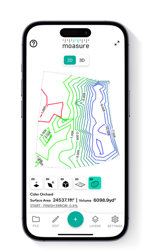
Contour View
The Contour View provides a 3D visualization of the landscape's topography using Moasure's captured elevation points, and helps you understand the site's slopes and undulations. View the site topography in 2D and 3D for even more detailed visualization.
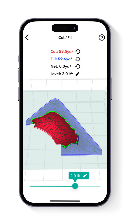
Cut / Fill tool
Calculate the volume of material needed to either excavate (cut) or add (fill) to bring a site to the desired level. Set your preferred level and instantly see the volume required for adjustments. The “zero net volume” feature shows the exact level needed to avoid any material movement, making it useful for leveling sites.
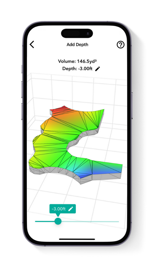
Add Depth tool
Designed for estimating material volumes based on specific depths, this tool calculates how much material (like sod, mulch or rock) is needed to cover a given area at a set depth. It’s effective for both flat and sloped sites, helping you avoid overestimating material costs and ensuring precise coverage.
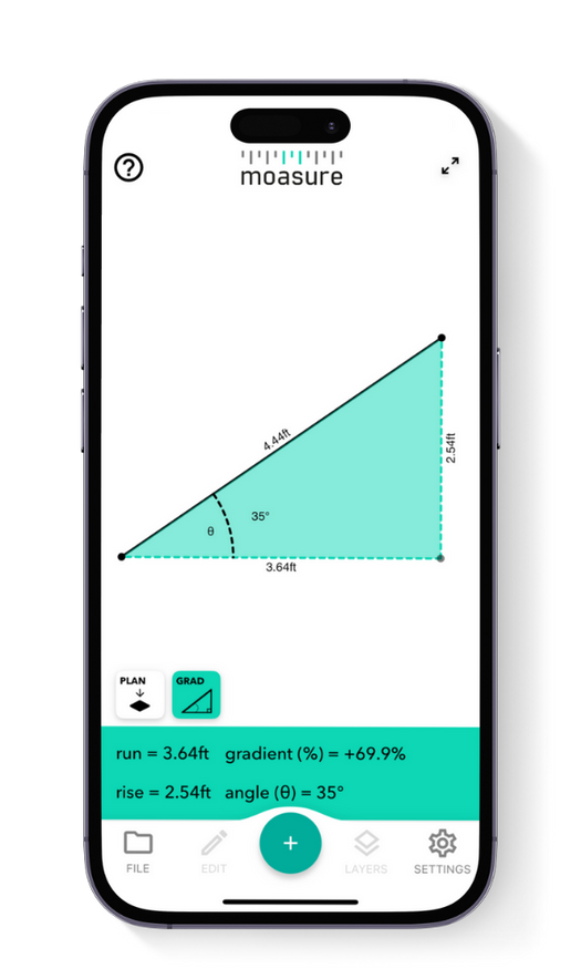
Point to Point
Measure the rise, run and gradient between two points using the Point-to-Point measurement type – perfect for assessing elevation changes across a site to ensure proper drainage for lawns, patios or other landscaped areas. It’s also ideal for checking straight-line distances when estimating materials for edging, retaining walls or pathways.
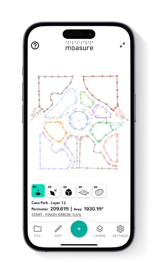
Layers
The Layers feature is ideal for mapping and maintaining landscaped areas, enabling users to separate and visualize aspects like patios, planting beds and lawn areas in one project. This simplifies site planning, helps identify potential drainage or grading issues early, and streamlines ongoing landscape maintenance.
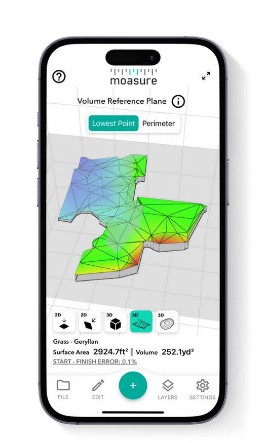
Surface Mesh view
This view creates a 3D surface map based on the measured area's shape and elevation, providing a clear and accurate representation of uneven or sloped terrain. It’s especially valuable in landscape construction, where changes in elevation can affect grading, drainage, retaining walls, and overall site planning.
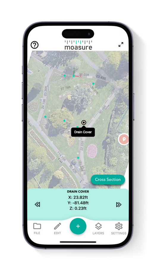
Add labels & backgrounds
Label points of interest and overlay your measurement on an aerial shot of the area to help clients or colleagues visualize your project. Label drains, low points, or other obstacles as you measure, or update a point after you've completed your measurement.
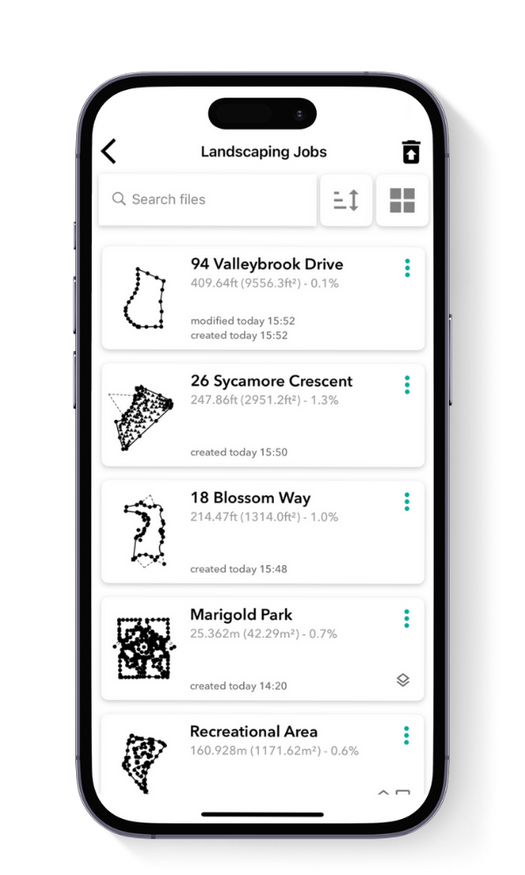
Organize your files
Save your Moasure files and organize them into folders, all within the app. Ideal for easy reference, simply access your measurements anytime you need them – Moasure’s organized file system streamlines your workflow and ensures quick access to your work.
Official supplier partner of:

Landscape Construction
Hardscaping
Lawn Care
Landscape Architecture
Landscape Design
Horticulture
Irrigation & Drainage
Built to handle all job sites
Moasure is designed to work in conditions most measuring tools cannot.
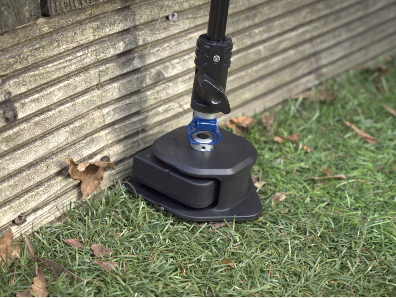


Water Resistant
IP67 Rated.
Measure in rain or mud.


Impact Resistant
Engineered to survive 6ft drops onto concrete.


10h
Long-Life Battery
Up to 10 hours of measuring time.


No GPS Required
No Wi-Fi, GPS or mobile data required.

2-Year Warranty
Can your measuring tape do
all of this?
Can your measuring tape do all of this?
Ditch the tape. Save time, cut waste, and streamline your workflow with Moasure
Measure & draw whilst you move

Measuring Tape
Measure elevations whilst you move
Measure around obstacles without line of sight
Automatically calculates square footage
Calculate depth & cut-and-fill
Export to PDF, CAD or CSV
Measure distances up to 99.7% accuracy
Accurately measure curved perimeters
Featured in:


Hear
real
stories from
real
landscaping experts
Hear real stories from real landscaping experts
Moasure is a game changer for landscapers. Let the experts tell you why:

CHOOSE YOUR MOASURE RISK-FREE
100% money-back guarantee
Every Moasure device is tested to ensure it meets our accuracy and precision standards.
Plus, every order comes with a 60-day money-back guarantee as standard.
Thousands of professionals have transformed their workflow with Moasure.
Give it a try and you’ll never look back.