The CAD software to use for Landscape Design, Planting and Irrigation.

Land F/X optimizes CAD and 3D platforms for landscape and irrigation design, including the ability to import accurate CSV data from your Moasure ONE.

Moasure & Land F/X Webinar

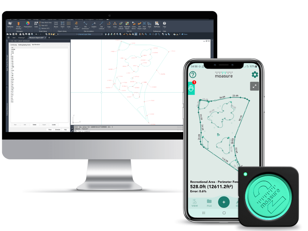
Takeoff with Land F/X

Land F/X optimizes AutoCAD and 3D platforms for landscape architecture and irrigation design. Land F/X can easily open .dxf files, and includes tools like Import CSV, which allows you to import accurate CSV data from your Moasure ONE. This platform makes it easy to mark irrigation equipment, tree locations, spot elevations, and other site features, building speed and accuracy into your site takeoff workflow. Check out these tools, plus many more that will help you take your designs to the next level.

Measure & Draw with Moasure

Measure and draw at the same time, capturing elevation changes as you go. All in a fraction of the time it used to take.

No more wasting time transforming scribbled measurements into drawings, Moasure does it all for you while you go.

Moasure makes light work of measuring large or small complex areas – accurately capturing measurement data and plotting a diagram as you move around.

Download sample DXF and CSV file

With just a few taps, export your completed measurement to a DXF or CSV format file - complete with X, Y, Z data for each measurement point.

In addition to a DXF and CSV, measurements can be exported to PDF so that you can share detailed drawings with colleagues or customers

You can then import the DXF or CSV into Land F/X.

Import Moasure ONE measurements into Land F/X

Your measurements can be quickly imported into Land F/X easily allowing for landscape architecture and irrigation design.

Use your Moasure ONE with Land F/X

Land F/X have software to use for Landscape Design, Planting and Irrigation.

Learn more about Land F/X